While Tropical Cyclone Oma might have veered off and petered out suddenly just as it looked like it was going to make historic landfall in Brisbane, Queensland is staring down the barrel of another oncoming cyclone: say hello to Trevor.
Tropical Cyclone Trevor is expected to develop into a category 3 cyclone before making landfall over the Cape York Peninsula coast. #CycloneTrevor. https://t.co/rVLE6i5J4y pic.twitter.com/EIvHQyhLNC
— Bureau of Meteorology, Queensland (@BOM_Qld) March 18, 2019
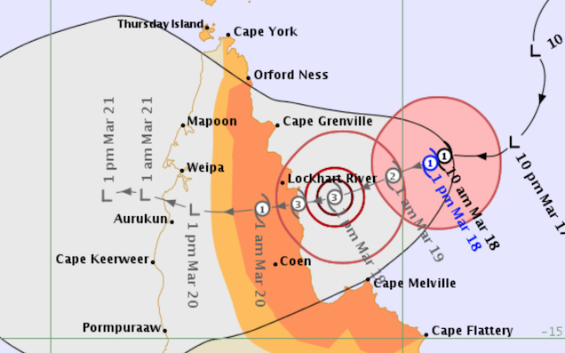
Trevor transformed from a tropical low into a category one tropical cyclone, with the Bureau of Meteorology currently predicting that Trev will cross the coastline north of Coen as a category three.
According to the Bureau, Trev is expected to make landfall on Tuesday evening. The entire coast from Cape Tribulation to Cape York has been placed in the gale watch area for the next 48 hours, with gusts of over 90km/h predicted for the coast between Cape Flattery and Orford Ness tonight.
The possibility of gusts upwards of 125 km/h is anticipated for the coast between Cape Grenville and Coen as the cyclone approaches Tuesday afternoon, with further gusts of up to 170 km/h expected at the point of landfall if the cyclone remains a category three.
The Bureau is recommending that people living between Orford Ness and Cape Flattery should immediately start preparing their property for the cyclone, using what daylight hours are available.
As per usual: Keep an eye on the weather warnings and check for updates frequently as conditions can change rapidly. If you are aware of people who may not be able to prepare themselves without assistance or who may be unaware of the approaching cyclone, reach out to them.
Stay safe!