Sure January feels like years ago, but it’s hard to forget how exponentially fucked everything was when the bushfires seemed to be everywhere. Now, after quite a few months, we finally have some satellite images to show just how dreadful the fires were to our Aussie landscape.
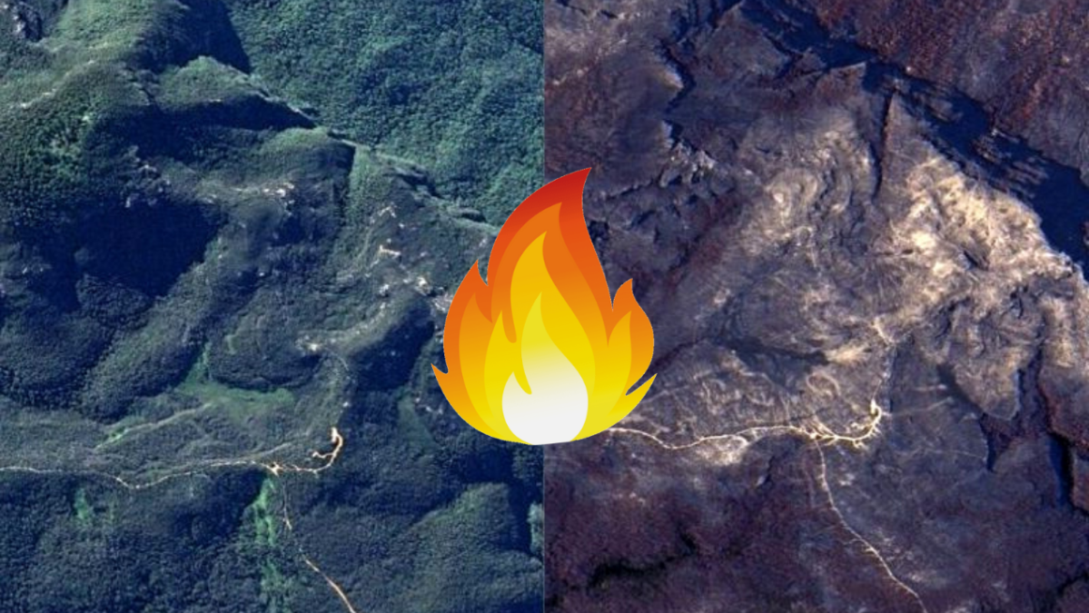
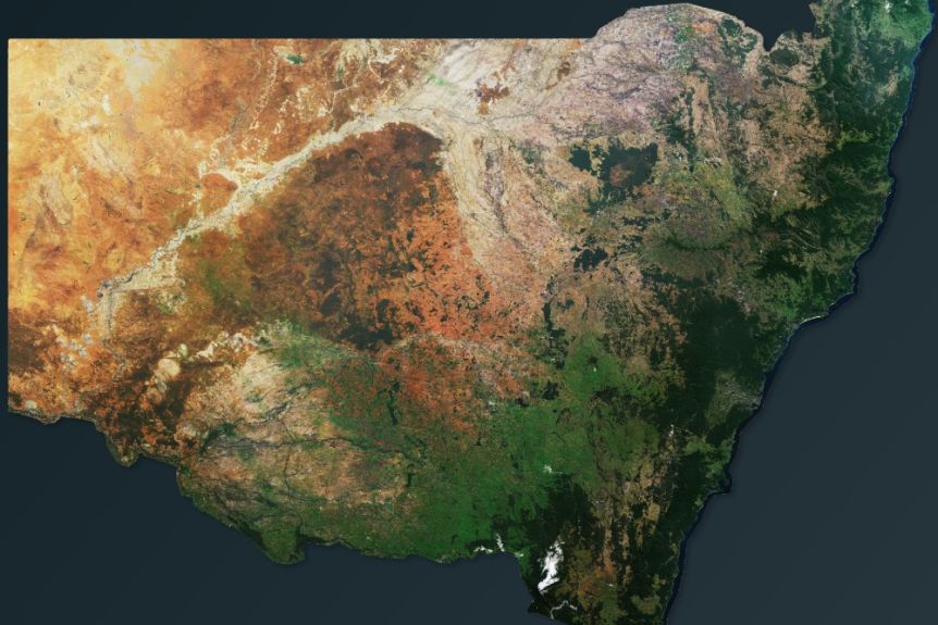
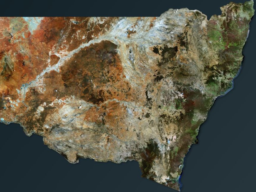
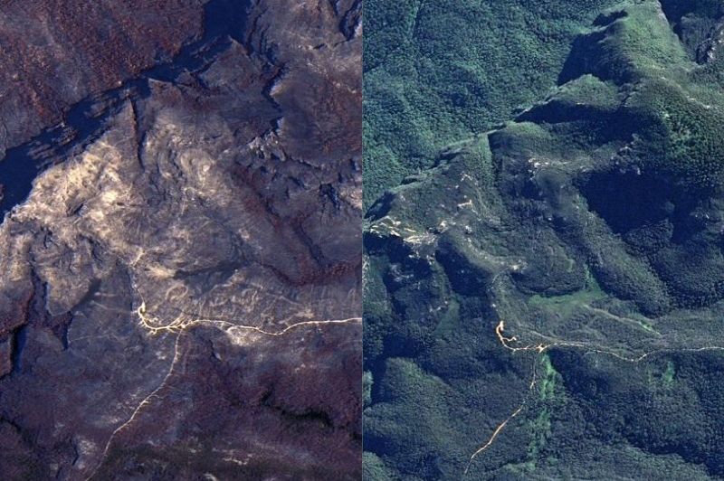
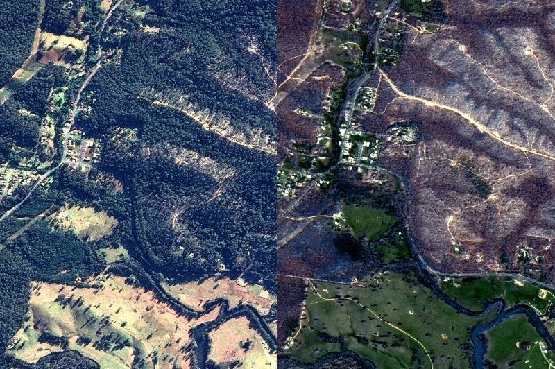
Thanks to Aussie aerial analysis company Geospatial Intelligence, these before and after pics of bushfire season really put into perspective just how much we lost. To put it in numbers, 5.5 million hectares across the state of NSW were torn apart by fire tornadoes and ravenous blazes, and they’ve only just started to recover.
“[Satellite imagery] has a very, very high value in the pre-fire planning periods, so this period now coming up into the fire season,” said Chief Executive of Geospatial Intelligence Rob Coorey.
“It’s not one panacea which is going to be the solution to everything, but it has a really great role to play and is, in actual fact, very cost-effective when you’re looking at the sorts of things the [Government] uses it for.”
Included in the images is a closer look at places like Mogo and Mt Wilson, which were hit especially hard by the fires.
You can have a look at the side by side comparison images below, which reveal just how intensely charred the grasslands were in these areas over New Years.
At least 33 people were killed during the Black Summer bushfires, including four firefighters. Things aren’t all in the clear, however, as just a few days ago the new bushfire season began, with NSW recording 702 bush, grass and scrub fires so far since July 1.


