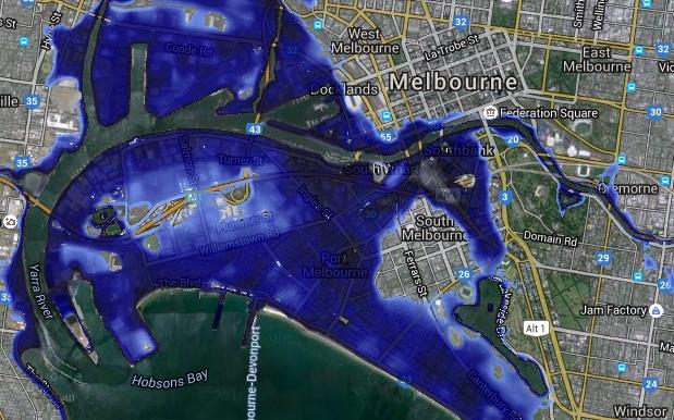
If you need a little but of cataclysmic terror panic in your morning, mapping company NGIS Australia has released a tool named Coastal Risk which shows you the projected sea level rise as a result of climate change overlaid on Google Maps imagery of Australian cities.
So you can see how long you have before rising sea levels destroy your beautiful little sharehouse, and maybe plan ahead to work out which housemate will be responsible for dealing with the carnage.

But seriously, according to IPCC projections, a sea level rise of one metre is likely by 2100. According to Coastal Risk’s modelling, that puts some houses and landmarks below sea level.
“We don’t want to create hysteria but we don’t want people burying their heads in the sand ether,” said Nathan Eaton, one of the creators of the website.
If you’re feeling particularly wild, the tool allows you to customise the sea level rise and see how it would look. So if you want to crank it up to five metres and beyond and watch Melbourne swallowed beneath the raging waves of the sea, you can do that.
Sorry Sydneysiders. It doesn’t make your sick fantasy a reality – however justified it may be.
Source: The Guardian.
Image: Coastal Risk.