Melbourne‘s grid system makes the city reasonably easy to navigate; everything is set out logically, the blocks are fairly evenly spaced, and once you understand the system of ‘Little’ streets you’ve pretty much got that shit on lockdown.
Spare a thought then for anyone stepping foot in the city for the very first time today utilising Google Maps to try and get around. There’s a fair-to-good chance they might’ve copped a gargantuan detour.
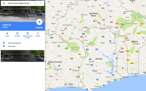
The ever-present GPS system had itself a wee little snafu earlier today when, somehow, it decided that Collins Street was not, in fact, nestled in between Little Collins and Flinders Lane in the middle of the CBD. Rather, it was somewhere in the middle of Ghana.


At the time of writing the glitch was still in effect, with a search for Collins Street on the desktop Maps taking you to some rough-looking terrain near the shore of Lake Volta in south-eastern Ghana, not too far away from the African nation’s easter border that it shares with Togo.
We’re not terribly sure if that still falls within the Free Tram Zone, but you’d better tap on when boarding the 11 just in case it hits some sort of time/space portal at around St. Vincent’s Plaza and shoots you off into what’s probably about Zone 542.
Source: The Age.


