There are multiple areas of NSW set to expect flooding over the next 24 hours, with heavy winds and possible landslides also of concern. The NSW State Emergency Service (SES) is urging those in areas at risk to be prepared to evacuate.
As reported by Sydney Morning Herald, a low-pressure system is expected to bring up to 100 millimetres of rain to New South Wales (in only a few hours, mind you) as Saturday’s rainfall intensifies through until midnight.
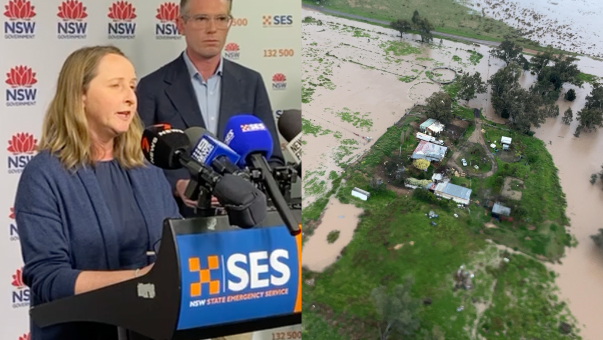
There are 66 flood warnings in place for residents across NSW. The SES has received more than 300 calls for help across the state and carried out six flood rescues.
The NSW SES requested extra help resulting in four defence helicopters that came online from 6 pm today. NSW residents are being asked to keep up to date with their local situations. NSW SES Facebook page is consistently posting updates on evolving situations throughout the state.
Dams are at 100 per cent capacity and rivers are full, with the Bureau of Meteorology warning that there is a chance of flash flooding this weekend. BoM’s Jane Golding said that the rain would intensify on Saturday through to early Sunday (east of the Great Dividing Range) during a press conference this afternoon.
Emergency Services Minister Steph Cooke said NSW has “a significant number of catchments” with “minor to moderate flood warnings in place”. Wagga Wagga, Forbes, Warren, Gunnedah and Bathurst are currently the primary areas of concern for the SES.
“We are only eight days into the storm season and unfortunately we are seeing flooding continuing across NSW, which continues to impact on our rural, regional and remote communities. It is expected to do so for weeks and, in fact, months ahead,” Cooke said.
Macquarie, Darling, Culgoa and Lachlan rivers are currently experiencing flooding with a risk of inundation for multiple inland catchments. Forecasters are worried about the possibility of landslides.
It’s also likely that Sydney and the Illawarra coast will experience damaging winds with peak gusts of more than 90km/h into Sunday.
Because flood peaks are moving down rivers which are already swollen around NSW, BoM is warning Gwydir, Namoi, Macquarie and Belubula rivers, Mandagery Creek, the Lachlan and Bogan rivers, Colo River, Wollombi Brook and Lower Hunter River of renewed risks.
We can expect the weather to ease by midday on Sunday. There’s even some sun on the cards for the start of the week. Beginning to forget what that thing looks like. During the conference today, Golding said:
“The good news is this system is moving through pretty quickly and we should have a couple of days of reprieve.”
Everyone stay safe and keep updated of what’s going on in your local area.