After being smug about our blue skies last summer it’s now Victoria’s turn to be splooged by a wet weather dong and this one’s gonna be big.
Premier Daniel Andrews has warned of flash flooding in Melbourne and across the state as residents brace for a deluge on Wednesday night and on Thursday.
Rainfall totals of up to 50mm are forecast for northern parts of Vic, southern New South Wales and northern Tasmania on Wednesday. It’s expected to come down harder in Victoria on Thursday with up to 80mm of rain expected in some parts. To put that into perspective, the state’s average rainfall for October — Melbourne’s wettest month — is 66mm. For the whole month. And in the first 12 days of this month, Vic has already copped 42.6mm. I for one am fucking terrified.
A very wet end to the week for #Victoria as a cold front crosses the State 🌧️⛈️
Heavy rainfall, localised flash flooding, & renewed river rises expected, with THURSDAY the peak day. #SevereWeatherWarning & #FloodWatch already current.
Warning details: https://t.co/UDgr0jG4FS pic.twitter.com/FYCVFuyVWp— Bureau of Meteorology, Victoria (@BOM_Vic) October 11, 2022
Andrews said all Victorian catchments are currently at capacity so the risk of flooding is real.
“We know that we’ve had record rainfall to this point and the ground is absolutely sodden so even a minor amount of rain would be a real risk in terms of flooding,” Andrews said.
“But it’s not a minor rain event that we are forecasting. There will be significant rainfall in certain parts of the state and that’ll pose a flooding risk to communities in lots of different places.”
Major warnings have been issued along parts of the Avoca, Loddon and Campaspe rivers and minor warnings have been issued for the Barwon, Goulburn, Kiewa, King, Snowy, Werribee and Yarra rivers. Good luck Abbotsford.
Emergency Management Victoria Deputy Commissioner Chris Stephenson urged people in flood-risk areas to prepare to be bunkered down for up to 72 hours. That means stock up on any medication or food you might need (anyone who orders Uber Eats during tomorrow’s storm is going to hell) and make sure your pets are safe and any special plants or outdoor items are undercover.
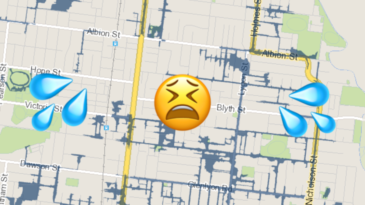
But how can you tell if your home or property is at risk of flooding?
Well, flood mapping is available on Victorian council websites.
For example, inner-north Melbourne’s Merri-Bek Council has an interactive map of the local government area that shows exactly which streets could flood based on location and drainage in the area.
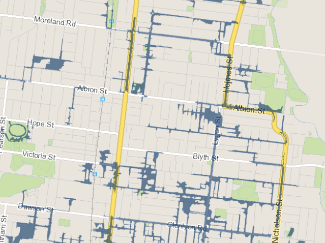
Other councils offer similar mapping on their websites, or you can check each region via the Department of Land, Water and Planning.
Regardless of where you live, everyone should take some safety precautions tomorrow.
SES Chief Officer Operations Tim Wiebusch said people should avoid driving on Thursday, so work from home if you can.
“Don’t drive into flash floodwaters, because it could be the last decision you ever make.”
Jesus.