I bet none of us had this on our 2021 Bingo cards: the Bureau of Meteorology has issued a tornado warning for western Sydney.
Yep, a “top priority” severe thunderstorm warning, which includes a tornado warning, has been issued for a series of NSW suburbs.
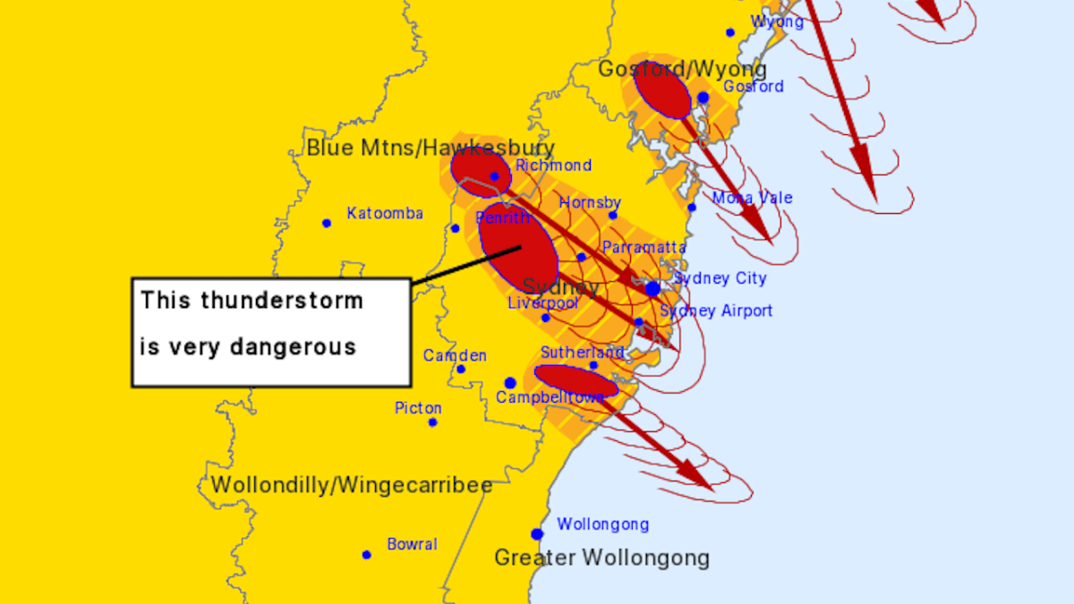
The BoM warns that “tornadoes, destructive winds, large, possibly giant hailstones and heavy rainfall that may lead to flash flooding” are likely for most of western Sydney, including the inner west and city areas.
RISKS OF TORNADO ACTIVITY ADDED TO WESTERM SYDNEY STORM https://t.co/RStl40Sl7L
— Bureau of Meteorology, New South Wales (@BOM_NSW) October 14, 2021
Tornado warnings have been made for the specific suburbs of Blue Mountains / Hawkesbury, Greater Newcastle, Gosford / Wyong and other Sydney and Greater Wollongong areas.
Severe thunderstorms are expected for the Richmond, Newcastle City, Engadine and Swansea areas, and is expected to move towards Woy Woy, Waterfall, Budgewoi, Manly, Stanwell Park and Gordon.
Dangerous thunderstorms (read: slightly less scary than severe ones) are expected to have already hit Horsley Park, Riverstone and Fairfield, and will move towards Parramatta, Sydney Airport, Sydney Olympic Park, Liverpool, Randwick, Sydney city and Sydney Harbour Bridge as the day progresses.
Crazy storm just hit penrith. The hail looks like snow 3 inches deep. Small stones. #SydneyWeather #SydneyStorms pic.twitter.com/Oz3HkyXmzs
— Scottie J – Man of Teal (@The_Man_Of_Teal) October 14, 2021
Stay safe out there friends, and maybe put off that big walk you had planned for the afternoon.
Bureau of Meteorology also recommends that you quickly do things like moving your car away from trees, unplug computers and appliances, do not drive or ride your bike through the storm, and stay indoors but away from windows.